With a month of poor weather and cabin fever not far away, not to mention the dodgy knee I was keen just to get out the house.
I telephoned my mate Chris for a chat and he mentioned that he was going for a short walk this afternoon to look at the ruins of the Pilgrims Rest at Llandeilo Abercowyn. I pleaded to go with him and he agreed!
Route http://www.ukhillwalking.com/logbook/e.php?d=20120629&u=129274
We parked the car near Cwm Celyn farm and started to walk towards the farm. The owner who was playing with his JCB said that his son had found a body that morning and the police were in attendance and may not let us through the land. However we carried on through the farm and onto the footpath through the small copse and onto the Pilgrims Rest and the ruins of St Teilo Church. The owner was very helpful and showed where the chapel was and gave some background to the Pilgrim's Rest. The chapel was somewhat overgrown but the farmer hoped to take a strimmer to the growth soon.
The map shows the path going through the farm and then north along the Cowyn. However there is now a short detour which leads east along the road and within a small distance a footpath sign puts you back on route. I have to say this area is poorly sign posted especially as it now forms part of the Wales Coast Path, not to mention the ground was very muddy and full of holes made by cattle - but this is West Wales.
We turned right at the road at Pont Ddu and after about a half a mile at the T junction headed along the well signposted path into the woods. Just past Gelli we turned south down the lanes back to the car just in time to miss the rain.
A 5.5 mile walk which gave me no knee problems and helped to blow away the cobwebs.
No pictures I am afraid.
Friday, 29 June 2012

Tuesday, 5 June 2012
St Helens Circular via Seaview
A holiday on the Isle of Wight for the week commencing 26th May saw me tentatively trying to walk without the knee protesting. I tried a one mile route along lanes and fields with no problem and with other short walks things were looking OK. On the Thursday I thought it was time for a longer walk and decided on a circular walk from our base in St Helens, cross country into Seaview and back along the coast.
The route can be seen here.
We followed a footpath north from the Field Lane caravan site, passing a well hidden trig point (49). It is usual to find these on hill tops not hidden in a wood. In one of the fields was a collection of cattle including bison, highland cattle and some unknown white cattle.


This path led to a road where we turned left and continued on into Attrill's Lane with spring flowers still blooming.

It is a feature of the Isle of Wight to see all footpaths sign posted with most showing a route number and destination. I wonder if anyone from Carmarthenshire County Council is reading this!
We turned off this path and headed past Park Farm and then onto Calthorpe Road where we stopped at the Duke of Westminster for a shandy. Much to our surprise the landlord was from Llandybie a village not far from our home and we had a short chat in Welsh!
The path next to the pub was then taken which led past a wildlife park and onto the coast. The coast path led into the quiet town of Seaview where we bought some posh sandwiches and ate them on the promenade next to the yacht club.


An interesting fact here is that the sign posted public toilets are actually in the local hotel!
Now refreshed and toileted we continued our walk along the coast walking on the sands of Seagrove Bay and Priory Bay, attractive beaches backed by woods.


We stopped at the latter for a sun break and read before continuing on to the beach just east of St Helen's. This did include a rock scramble as the tide was heading our way.

Once safely across we arrived at the area known as The Duver where yet another stop was had to consume ice cream.
We crossed the causeway which overlooks Bembridge Harbour and walked back into St Helen's across the village green where we had already seen a couple of cricket matches. It was now getting ready for the jubilee celebrations with a marquee erected. Unfortunately we will miss one interesting event which was billed as a "jelly fight" taking place on the Saturday.
Some 6.5 miles later and the knee was doing well albeit it was not a strenuous hill walk but still good to be out without pain.
The route can be seen here.
We followed a footpath north from the Field Lane caravan site, passing a well hidden trig point (49). It is usual to find these on hill tops not hidden in a wood. In one of the fields was a collection of cattle including bison, highland cattle and some unknown white cattle.


This path led to a road where we turned left and continued on into Attrill's Lane with spring flowers still blooming.

It is a feature of the Isle of Wight to see all footpaths sign posted with most showing a route number and destination. I wonder if anyone from Carmarthenshire County Council is reading this!
We turned off this path and headed past Park Farm and then onto Calthorpe Road where we stopped at the Duke of Westminster for a shandy. Much to our surprise the landlord was from Llandybie a village not far from our home and we had a short chat in Welsh!
The path next to the pub was then taken which led past a wildlife park and onto the coast. The coast path led into the quiet town of Seaview where we bought some posh sandwiches and ate them on the promenade next to the yacht club.


An interesting fact here is that the sign posted public toilets are actually in the local hotel!
Now refreshed and toileted we continued our walk along the coast walking on the sands of Seagrove Bay and Priory Bay, attractive beaches backed by woods.


We stopped at the latter for a sun break and read before continuing on to the beach just east of St Helen's. This did include a rock scramble as the tide was heading our way.

Once safely across we arrived at the area known as The Duver where yet another stop was had to consume ice cream.
We crossed the causeway which overlooks Bembridge Harbour and walked back into St Helen's across the village green where we had already seen a couple of cricket matches. It was now getting ready for the jubilee celebrations with a marquee erected. Unfortunately we will miss one interesting event which was billed as a "jelly fight" taking place on the Saturday.
Some 6.5 miles later and the knee was doing well albeit it was not a strenuous hill walk but still good to be out without pain.
Friday, 18 May 2012
Stop to Procedures
Following a major knee ioncident prior to Easter 2012, my walking has come to end (hopefully just for now). Off to see a (no doubt pricey) consultant on 8th June to see what can be done. Thankfully I have found that cycling is pain free - see http://randombikerides.blogspot.co.uk/
Also hope that I can keep canoeing albeit not kneeling.
Also hope that I can keep canoeing albeit not kneeling.
Friday, 27 April 2012
Welsh Coastal Path - Clean Up at Llansteffan
With a week to go before the official opening of the All Wales Coast Path various clean ups are taking place.
During the last mile of my previous walk my knee decided to call a halt to future walks! Although a scan in October last had shown a tear in a ligament it had not caused any problems until the Thursday before Easter when on the Bronwydd walk. A long story short is that I am now on a waiting list for an Arthroscopy operation. I really hope that will cure the problem.
Anyway with cabin fever making an appearance I thought a short stroll on the beach at Llansteffan would be fine both for me and the beach.


Despite the rain pouring down a few hardy souls were given the kit and off we set to pick up litter.

It was pleasing to see that although this is a popular beach there was not a huge amount of rubbish to collect.
Not sure why amongst my collection were two pair of underpants and a solo flip flop, but no doubt there is a story attached. I also found one of those instant Bar B Q foil things and why do people just leave burnt out pieces of wood when they light fires. LEAVE NO TRACE.


If you are walking in this area then a slight detour to visit the castle is worthwhile which has good views over the Tywi estuary towards Ferryside.


Thankfully the knee behaved quite well with only one "ouch" when I stepped awkwardly on the bank.
Unfortunately these random notes may become even more random for a few months.
During the last mile of my previous walk my knee decided to call a halt to future walks! Although a scan in October last had shown a tear in a ligament it had not caused any problems until the Thursday before Easter when on the Bronwydd walk. A long story short is that I am now on a waiting list for an Arthroscopy operation. I really hope that will cure the problem.
Anyway with cabin fever making an appearance I thought a short stroll on the beach at Llansteffan would be fine both for me and the beach.


Despite the rain pouring down a few hardy souls were given the kit and off we set to pick up litter.

It was pleasing to see that although this is a popular beach there was not a huge amount of rubbish to collect.
Not sure why amongst my collection were two pair of underpants and a solo flip flop, but no doubt there is a story attached. I also found one of those instant Bar B Q foil things and why do people just leave burnt out pieces of wood when they light fires. LEAVE NO TRACE.


If you are walking in this area then a slight detour to visit the castle is worthwhile which has good views over the Tywi estuary towards Ferryside.
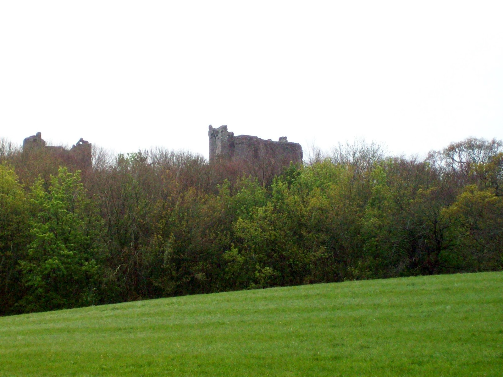
In the main seasons I can recommend the fish and chips sold at Florries located in the car park and the tea and cakes in the cafe just a few yards away.

Thankfully the knee behaved quite well with only one "ouch" when I stepped awkwardly on the bank.
Unfortunately these random notes may become even more random for a few months.
Thursday, 5 April 2012
Circular walk north of Carmarthen
One of my favorite sayings is "Man Plans and God Laughs". Today I should have been on day 2 of a backpack with my brother- in- law walking in the Elan Valley area. However the hot weather of recent times suddenly turned to snow and high winds and being of the wimpish (sensible) mode we cancelled.
My usual navigator who normally walks on a Thursday had decided not to and I was therefore left to my own devices and as the sun was out I had to go somewhere. There is an excellent book by Alan Richards in which he describes 10 Great Walks in Carmarthenshire and so far they have been spot on. One I had not done was his Bronwydd- Newchurch walk and so off I went.
I parked in the car park at Bronwydd Village Hall and if anyone is reading this who also enjoys kayaking/canoeing then the first photograph shows the HQ of Whitewater Consultancy a business started by the late Huw Evans who passed away far too young.


The river is the Afon Gwili and again if you paddle, this is an excellent grade two run with a grade three drop known locally as Bronwydd Falls - about the only rapid I have not swum!
The walk takes in the true left bank heading downstream and on to the main A464 where there is a plaque commemorating the now demolished pub, "The Bronwydd Arms "which gave the village its name and was also famous for pub game known as Tip It.

A short way down the main road the route takes a right turn and we head off into the countryside with lots of newborn lambs about.

Once back on the road fine views of Carmarthen can be seen.

It was on this road a car stopped and asked if I wanted a lift - my neighbour on his way to Carmarthen Golf Club. I of course refused and carried on by foot.
The route then again leaves the road and follows a fine bridleway by a farm with a very posh sign.

This path leads to Newchurch (Llannewydd).

Just inside the graveyard is an informative information panel which includes a story about the Rebecca Riots.

The graveyard also has two war memorials with just a few names of those locals lost in the Great War, always sad.

A little further on another bridleway is walked which leads to a lovely path through woods, although some landowner has erected a sign which warns of terrors ahead. I did come across two large trees which had fallen across the path, but nothing else one would not expect on a country walk.

This path leads to the main A484 and the property which was once a pub called the Rock and Fountain. before it became a private residence it was here paddlers gained access to the Afon Gwili, but no longer.
Our route however turned right before the road was reached and struck steeply uphill through the woods and then across the golf course onto the road.

A little further downhill a "No Through Road " is taken and once again a lovely track passing a farm I was told could be yours for £2million and also fine views takes you all the way to Cwmdwyfran Farm and back again to the A464.


Just past the small housing estate the route crosses the road and across the fields down to the Afon Gwili.

The route follows the river downstream back to the car park. There is another information panel here which describes how the local home guard manned a pill box opposite the Rock and Fountain in case the enemy called!


Mr Richards is in the middle of publishing volume 2 of his walks and I look forward to walking them.
My usual navigator who normally walks on a Thursday had decided not to and I was therefore left to my own devices and as the sun was out I had to go somewhere. There is an excellent book by Alan Richards in which he describes 10 Great Walks in Carmarthenshire and so far they have been spot on. One I had not done was his Bronwydd- Newchurch walk and so off I went.
I parked in the car park at Bronwydd Village Hall and if anyone is reading this who also enjoys kayaking/canoeing then the first photograph shows the HQ of Whitewater Consultancy a business started by the late Huw Evans who passed away far too young.


The river is the Afon Gwili and again if you paddle, this is an excellent grade two run with a grade three drop known locally as Bronwydd Falls - about the only rapid I have not swum!
The walk takes in the true left bank heading downstream and on to the main A464 where there is a plaque commemorating the now demolished pub, "The Bronwydd Arms "which gave the village its name and was also famous for pub game known as Tip It.

A short way down the main road the route takes a right turn and we head off into the countryside with lots of newborn lambs about.

Once back on the road fine views of Carmarthen can be seen.

It was on this road a car stopped and asked if I wanted a lift - my neighbour on his way to Carmarthen Golf Club. I of course refused and carried on by foot.
The route then again leaves the road and follows a fine bridleway by a farm with a very posh sign.

This path leads to Newchurch (Llannewydd).

Just inside the graveyard is an informative information panel which includes a story about the Rebecca Riots.

The graveyard also has two war memorials with just a few names of those locals lost in the Great War, always sad.

A little further on another bridleway is walked which leads to a lovely path through woods, although some landowner has erected a sign which warns of terrors ahead. I did come across two large trees which had fallen across the path, but nothing else one would not expect on a country walk.

This path leads to the main A484 and the property which was once a pub called the Rock and Fountain. before it became a private residence it was here paddlers gained access to the Afon Gwili, but no longer.
Our route however turned right before the road was reached and struck steeply uphill through the woods and then across the golf course onto the road.

A little further downhill a "No Through Road " is taken and once again a lovely track passing a farm I was told could be yours for £2million and also fine views takes you all the way to Cwmdwyfran Farm and back again to the A464.


The route follows the river downstream back to the car park. There is another information panel here which describes how the local home guard manned a pill box opposite the Rock and Fountain in case the enemy called!


Mr Richards is in the middle of publishing volume 2 of his walks and I look forward to walking them.
Tuesday, 27 March 2012
Pembrokeshire Coast Path - Goodwick Round
With British Summer Time just starting and a weather forecast to match, the Navigator suggested a coastal walk. No argument from me.
We parked the car at the front in Goodwick, free parking until 1st April. The plan was to walk inland and then return on the coast path.


We parked the car at the front in Goodwick, free parking until 1st April. The plan was to walk inland and then return on the coast path.

From the car park we headed uphill on footpaths in the general direction of Llanwnda.
The next photo will bring a smile to canoeists.

Unfortunately it was next to an ornamental pond. From the bridal way we passed the horse riding establishment and joined a minor road and then up onto the open ground of Garnwnda. This gave 360 degree views of the surrounding countryside and coast and a good spot for coffee.


It was a bit of a clamber down to the lower ground but we made it without the use of ropes.

The route then continued along the lane leading past Pant Eglwys to join another minor road.
We continued along here until the footpath leading to the National Trust properties of Good Hope and Penrhyn. The footpath sign is misleading as it indicates the path only goes to the cottages but it will bring you to the coast path. As you descend the path the sea comes into view and we saw the Irish ferry making its way to Fishguard.
This path contains two sets of stepping stones, the first being fine but the second which leads around Penrhyn stops short of a boggy area - I KNOW from a wet experience.


We had lunch on Trwyn Llwyd and it would have been no trouble to have a snooze but it was not to be and on we strode.
We soon reached Carreg Wasted Point where the French landed in 1797 to be captured by a load of feisty Welsh ladies. Just last weekend the glorious Welsh rugby team also beat the French to claim yet another Grand Slam - CYMRU AM BYTH.

We were not the only ones at Carreg Wasted and anothe couple were having a break and told us they could hear a seal who was probably within the bay of Aberfelin.

As we walked on we kept an eye out and spotted about four seals swimming in the clear water. From time to time they surfaced to look at us.

The coast path here does go and down a bit but with lovely views such as the headland below known as Penfathach.

We were now heading back to Goodwick and the car. On the way we passed a beacon brazier, bizarrely supported by British Gas as there was no sign of any gas line.

The tide was right out by now.

A glorious day was had by us all.
Monday, 12 March 2012
Twrch Valley (and the convertible pullover)
Agreement this week was reached to walk up the Twrch Valley from Ystradowen and return over Carn Fadog and down the straight incline back to the car.
We walked up the true right bank of the Afon Twrch to Bryn Henllys Bridge and crossed to the other side of the river and followed the Ffordd y Glowyr (The Colliers Way), a dismantled railway.

The Navigator told me that when they were last in the area this route had been closed. Today however it was very much open and clearly a lot of work had been put into it, very pleasant.


The weather which we had left behind was foggy and dreary, but we were now in full blue sky and walking in shirt sleeves. Looking back the valleys were in cloud all day. We came across a ruined cottage which was in the throes of early renovation. The on site owner told us he was 78 and would probably not see the finished job! We wished him a successful project .
From hereon the ground was very wet and we wondered what it would be like after a normal winter. An early lunch was had next to the waterfall near the map name Llwyncwmstabl.


More wet walking continued until Terry and I heard, "Help". Janice had stepped into a bog up to her nether regions and had to be pulled out by both of us. I did not dare to take a photo.
With a soaking wet companion we decided not to continue to Nant Y Llyn but to cut up to Ffrydiau Twrch. A lovely steep stream whose source we found bubbling from underground.


We had a second lunch here and with girl guide skills Janice removed her very wet trousers and somehow with the help of my Swiss army knife made a passing pair of "Ron Hills" from a pullover. This was a good example of never taking anything on the hill which does not have two uses!
Our proposed return over Carn Fadog was now amended to the area below Cefn Carn Fadog and the disused quarry and onto the incline which is as straight as an arrow! There were some good views of the area from here.


Unfortunately part way down it becomes a nightmare of wet bog and so we headed a little southwest towards Coedcae Mawr and over the footbridge at Ddol-gam which housed six noisy collies and some goats.

We could now look forward to a dry walk back first along a concrete roadway and then a rough track above the Afon Twrch back to the car.
This is a good area for some backpacking and if one follows the Afon Twrch to its source you will reach the Carmarthen Fans and the heart of the Black Mountain. No need to visit Scotland for wilderness.
We walked up the true right bank of the Afon Twrch to Bryn Henllys Bridge and crossed to the other side of the river and followed the Ffordd y Glowyr (The Colliers Way), a dismantled railway.

The Navigator told me that when they were last in the area this route had been closed. Today however it was very much open and clearly a lot of work had been put into it, very pleasant.


We continued to the wooden footbridge and headed towards the tall chimney and the disused lime and brick works. The information panel seemed to indicate the full history of the area was not known which seems strange as it was in historical terms quite recent.


The weather which we had left behind was foggy and dreary, but we were now in full blue sky and walking in shirt sleeves. Looking back the valleys were in cloud all day. We came across a ruined cottage which was in the throes of early renovation. The on site owner told us he was 78 and would probably not see the finished job! We wished him a successful project .
From hereon the ground was very wet and we wondered what it would be like after a normal winter. An early lunch was had next to the waterfall near the map name Llwyncwmstabl.


More wet walking continued until Terry and I heard, "Help". Janice had stepped into a bog up to her nether regions and had to be pulled out by both of us. I did not dare to take a photo.
With a soaking wet companion we decided not to continue to Nant Y Llyn but to cut up to Ffrydiau Twrch. A lovely steep stream whose source we found bubbling from underground.


We had a second lunch here and with girl guide skills Janice removed her very wet trousers and somehow with the help of my Swiss army knife made a passing pair of "Ron Hills" from a pullover. This was a good example of never taking anything on the hill which does not have two uses!
Our proposed return over Carn Fadog was now amended to the area below Cefn Carn Fadog and the disused quarry and onto the incline which is as straight as an arrow! There were some good views of the area from here.


Unfortunately part way down it becomes a nightmare of wet bog and so we headed a little southwest towards Coedcae Mawr and over the footbridge at Ddol-gam which housed six noisy collies and some goats.

We could now look forward to a dry walk back first along a concrete roadway and then a rough track above the Afon Twrch back to the car.
This is a good area for some backpacking and if one follows the Afon Twrch to its source you will reach the Carmarthen Fans and the heart of the Black Mountain. No need to visit Scotland for wilderness.
Subscribe to:
Posts (Atom)