Monday 25 March 2013

Solva - Pembrokeshire


The Navigator and his better half were back from their holiday, apparently in Austria and not as previously reported, Switzerland.  An easy error to make.

Despite the continuing freezing weather it was decided to man up and head west for the Pembrokeshire coastal village of Solva. This is my favourite coastal village having spent a number of family holidays here and which sparked my interest in kayaking and then open boating.


On the way to Solva there is another sight which lives the spirits and that is the sudden view of the coast above Newgale beach and the coast looking west.

We parked in Solva Harbour, which although free today, now charges for parking in the summer (possibly at Easter and other Bank Holidays).


 We headed uphill towards the church at Whitchurch and then onto the old airfield and around the edge to join a minor road where we turned west and down a footpath to Trevinert.  The walk down the valley started well but muddy in places and an awkward stream crossing.


Y Gorsedd


Posh Shed


At Caer Bwdy Bay we turned east and walked back to Solva following the Pembrokeshire Coast Path.

Caer Bwdy

Add caption


The day stayed cold with the occasional but brief bursts of welcome sunshine.


Tuesday 19 March 2013

Cwmdu - Taliaris

With 'The Navigator" still sorting out his secret Swiss bank account it was left to me and Chris to choose a route.

Plan A on Sunday evening was to walk in "The Navigator's" village of Meidrim from a route in Alan Richards book (volume 2).

On Monday there was a bit of mind changing, should we instead have a bike ride in Brechfa Forest, fun but too short. A decision was made to forgo Meidrim and instead again from Alan Richard's book walk his route based on Cwmdu and Taliaris.

Route

We parked up in Cwmdu near the Cwmdu Inn and Post Office which are now  National Trust Properties and set off forgetting Chris' flask which had fallen from the car and lodged under the car wheel.

Chapel in Cwmdu Village

All part of the pub complex

The village green (brown)


We headed south east towards Llethr Mawr and climbed upwards and came to a lake and then had fine views of the snow covered Bannau Sir Gar (Carmarthen Fans) and Mynydd Du (Black Mountain) in the distance. In fact we had frequent views of that range and at one point Corn Du and Pen-y-Fan also coloured white.

A lake in the hills


View over to Carmarthen Fans

Distant views of Fans

We could see pen Y Fan & Corn Ddu

Just before Taliaris Mansion we walked past a fine renovated property and walked down its drive.

Despite "private" this is the route

Taliaris Mansion


We continued on following Alan's exact instructions.

It will be nice when finished


Potholing? Not for me

Highland cattle?

An excellent seat for coffee

Back in Cwmdu we saw the two old style lavatories, one for the school and the other for the pub's customers.  One of the toilets was a two seater.  One matter of concern, at least to us was obvious signs of outlets straight into the river - also used for baptisms!

Outside loo


Not sure about the apparent drainage system

We recovered Chris's flask, drunk the contents and headed home.

PS

near Cwmdu is Tipi Valley

Wednesday 13 March 2013

Burry Port/Mynydd Penbre


We walked on Tuesday this week as it suited our little team, made smaller by the absence of "The Navigator" and his much better half - traipsing in the Swiss Alps somewhere.  I hope he doesn't bring me back another cuckoo clock!

Anyway I assumed the role of "The Navigator" - pause for laughter.  However I was being led by the route in Alan Richards book 'Great Walks in Carmarthenshire -vol 2" Both vol 1 and 2 are excellent guide books.

The route chosen was Burry Port - Mynydd Penbre.


Burry Port Marina

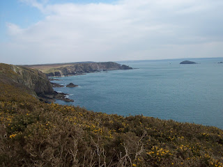
Despite visiting the marina at Burry Port on numerous occasions or just passing through we discovered there was much to see with good views of the Gower as we climbed higher.

View towards the Gower and Worms Head

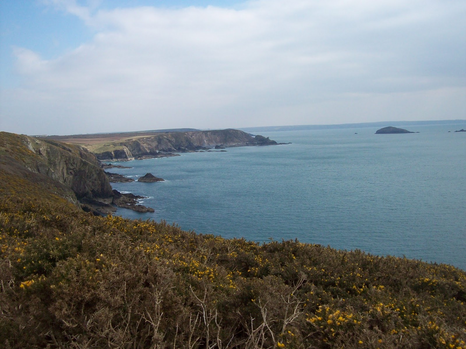
Another view to Gower

Mr Richards route descriptions are usually spot on but we did have a slight problem finding our way within the town, but unlike most blokes I did ask a local and we were off.

We were soon walking up the delightful Cwm Capel passing the chimney stack of the former Cwm Capel Colliery and then Carmel Chapel - they must have had a fit congregation as it is on a steep hill.

Still very cold

Colliery chimney

Capel


This walk has 25 kissing gates to pass through, not to mention other gates! Must have been a lot of chapped lips hereabouts.

We had lunch at the Pen Y Mynydd picnic site on Pembrey Mountain, a bit of a misnomer as at no time does it exceed 180 metres.  However the views from the picnic site are extensive to include the  Ffos Las Racecourse between Carway and Trimsaran, the Gwendraeth Fawr Valley, Kidwelly Castle and the Preseli Hills.

Ffos las race course in the distance


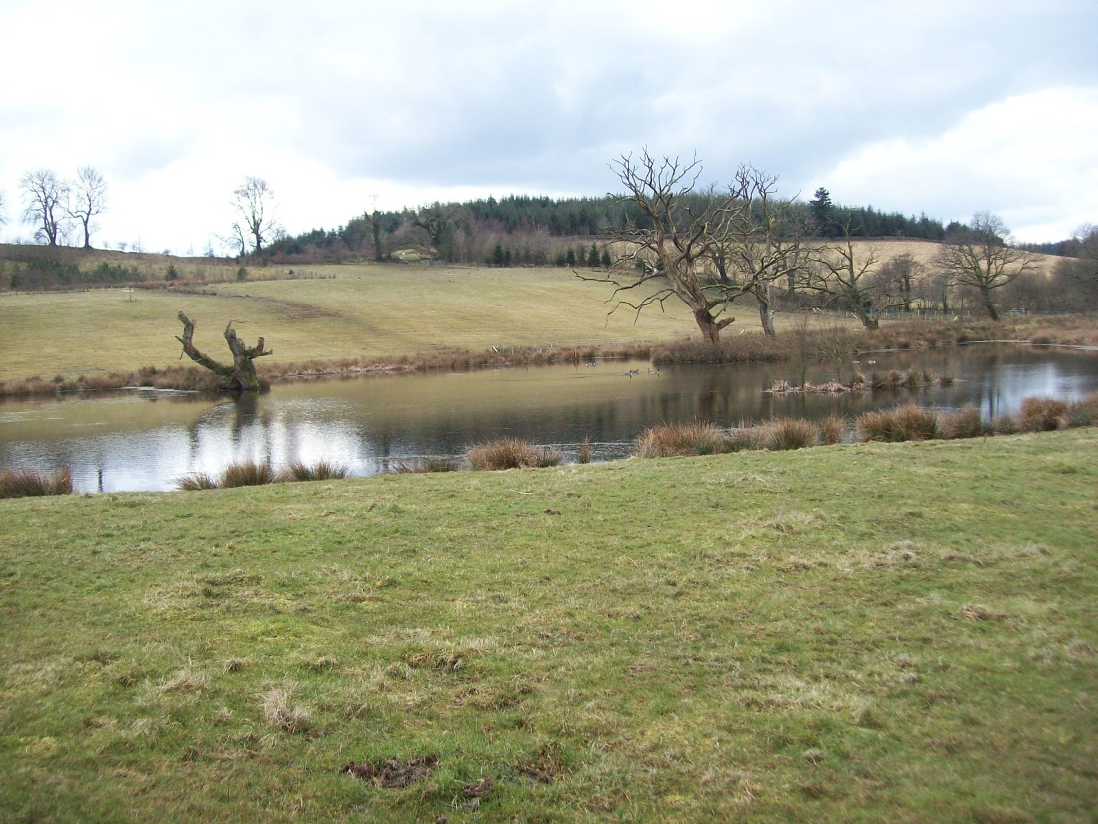
We walked some nice lanes passing a remote cottage which we think was probably a holiday let.

One of the green lanes


A quiet place to stay


New footbridge

A redundant style

As we headed downhill towards Pembrey Village we passed the ruins of Cwrt Pembre now in ruins but clearly an old house of some importance.

Cwrt Penbre


Mr Richards research shows that buried in St Illtyd's Church in Pembrey lies the body of 12 year old Adeline Coquelin who was the niece of of Napoleon,s consort. She was on the French ship "la Jeune Emma' which sank during thick fog on 21st November 1828 on cefn Sidan Sands.  The book does not say why the boat was heading this way.


St Illtyds

Mr Richards also relates the request of the Rev H Evans for a 'dead house" to be erected to house the numerous dead seamen which were being washed ashore in Pembrey.  It seems the church was being used as a mortuary which was uncomfortable for the congregation! No 'dead house' was built.

One other famous person connected with this area, although there is some dispute between two local villages of the exact place was the arrival of Amelia Earhart when as a passenger she became the first woman to fly over the Atlantic Ocean.

We crossed the golf course and headed back to Burry Port along the Millenium Coast Path

Monday 4 March 2013

Newport and Carn Ingli

Just me and "The Navigator' today and we were off to the seaside and an inland hill.

The long lasting dry period was still with us and we had good stretches of sunshine.

Route

We parked the car near the bridge which crosses the Nefern and then walked along the coast passing the Parrog below Newport and a coffee break overlooking Newport Bay.


Very little to be seen today


Two desirable homes on the Nefern estuary


Dinas head in the distance

We carried on along the coast and cut up through the valley by Aber Fforest passing a picturesque waterfall. The footpath which led to the right was then taken which leads up to the main road and across to a continuing path leading on the hillside above Newport and our route to Carn Ingli.


At Carn Edward we had an afternoon coffee coming close to a snooze in the sunshine.

Carn Edward

We soon reached our high spot of Carn Ingli where there were reasonable 360 degree views although the weather was not fully clear.

View from Carn Ingli

Another view from Carn Ingli

Looking back up to Carn Ingli

We climbed down and took a path which led us back to the car via a stop at an ancient cromlech, Carreg Coetan.


Carreg Coetan