Wednesday, 24 September 2014

Dale

It was to be just me and the "Navigator" for Monday`s walk as Mrs Navigator was staying home to nurse a raging toothache and to ensure the chimney sweep did a good job.

The decision on the destination had been suggested by me and a coastal walk to the Dale peninsula on the Pembrokeshire Coast was our objective.


It was yet another fine September day with mirror calm seas. The only black spot was the fact that we had to pay for parking - free from October to end of March.

Route

We took a path heading to the neck of the peninsula across a second world war airfield to Hoopers Point to look across the empty expanse of Marloes Beach towards Skokholm Island. Not far from here we had our first coffee break.

Skokholm Island

Marloes Beach and Gateholm Island

Turning south we walked along the coastal path heading back to the car. Usually on our walks we see few people but today it was extremely busy with a number of walkers on a walking holiday taking advantage of a baggage transfer system.


The biggest group was a class of teenagers on a field trip possibly from the Dale Fort Centre.

As well as our lunch boxes we grazed on the abundance of blackberries.

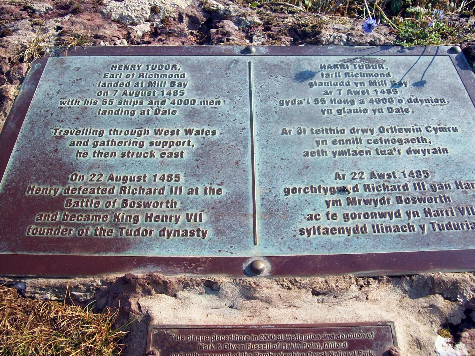
There was also some interesting history connected with Dale as it was here that Henry Tudor and his followers landed.


No wonder he picked this lovely part of Wales.


Why travel to the Med.?

Irish Ferry

On entering Dale village we came across the sculpting work of Sean Kehoe


Wednesday, 17 September 2014

Foel Fraith and Area

Just to cause confusion the "navigator" who is just back from the Alps thought a Wednesday walk would be a good idea and his suggestion was a walk in the Foel Fraith area.

Route

We parked at the lower car park on the road which leads from Llangadog to Brynamman. This road recently appeared on the ITV4 Bike Show as one of the best hills for cycling. Presumably for those with lungs and legs of steel.

We walked up into the quarry which is now part of an interpretative trail which explains the limestone industry. There is a link here, although the web site needs updating as the trail is now marked and in being.

Route of new limestone trail

Trail marker

We left the trail and headed for the waterfalls of the Afon Clydach which with the recent lack of rainfall was lacking in splendour.  We did however see a leylandi tree which appeared out of kilter with the landscape.

How did that tree get there?

The route continued to overlook the Tyle Garw and turned south to wander over the wilderness to disused quarry buildings where we had lunch.

A deep shake hole

pond

The return journey headed over Cefn Carn Fadog, Foel Fraith and the unnamed top at the trig point at 616m before heading back down to the car.

Trig at unnamed summit

No idea

Carn on unnamed summit