Sunday, 12 October 2014

Mynydd Llangendeirne

With the forecast for my usual walking day, Monday, looking grim I made the most of a blue sky Sunday for a local walk. I can see Mynydd Llangendeirne from my back garden and there is a good circular walk that can be made from home.

Route


Tree lined lane near Cwmisfael

Recycled post boxes


The area surrounding the top is known for artefacts including a small cromlech which at last I found and photographed.


The views from the top were clear with views of the Preselis, The National Botanic Garden Great Glasshouse, Paxton Tower and many villages throughout the area.


The Tywi Valley to the north still had mist despite it had gone mid morning.


Something new on the mountain were a number of interpretation panels and a compass with distant points outlined.


On the way home I came across some curious horses and then crossed the Afon Gwendraeth Fach,

Curious horses
Gwenraeth Fach

Friday, 3 October 2014

Mon and Brec Canal

Not a walk but a paddle on the Mo. and Brec. Canal

My stern paddler today was Judy and we paddled east passing through Llangattock and after lunch turned to head back to our start.


The weather was yet another day of good weather but with autumn in the air and the trees turning colour.


Surprisingly there were a number of narrow boats chugging along.

Judy stopped the canoe at one point to show me a huge wellingtonia tree and this was indeed worth stopping to see.


Wednesday, 24 September 2014

Dale

It was to be just me and the "Navigator" for Monday`s walk as Mrs Navigator was staying home to nurse a raging toothache and to ensure the chimney sweep did a good job.

The decision on the destination had been suggested by me and a coastal walk to the Dale peninsula on the Pembrokeshire Coast was our objective.


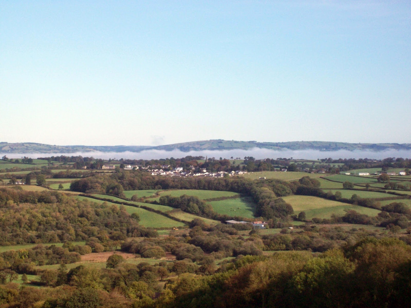
It was yet another fine September day with mirror calm seas. The only black spot was the fact that we had to pay for parking - free from October to end of March.

Route

We took a path heading to the neck of the peninsula across a second world war airfield to Hoopers Point to look across the empty expanse of Marloes Beach towards Skokholm Island. Not far from here we had our first coffee break.

Skokholm Island

Marloes Beach and Gateholm Island

Turning south we walked along the coastal path heading back to the car. Usually on our walks we see few people but today it was extremely busy with a number of walkers on a walking holiday taking advantage of a baggage transfer system.


The biggest group was a class of teenagers on a field trip possibly from the Dale Fort Centre.

As well as our lunch boxes we grazed on the abundance of blackberries.

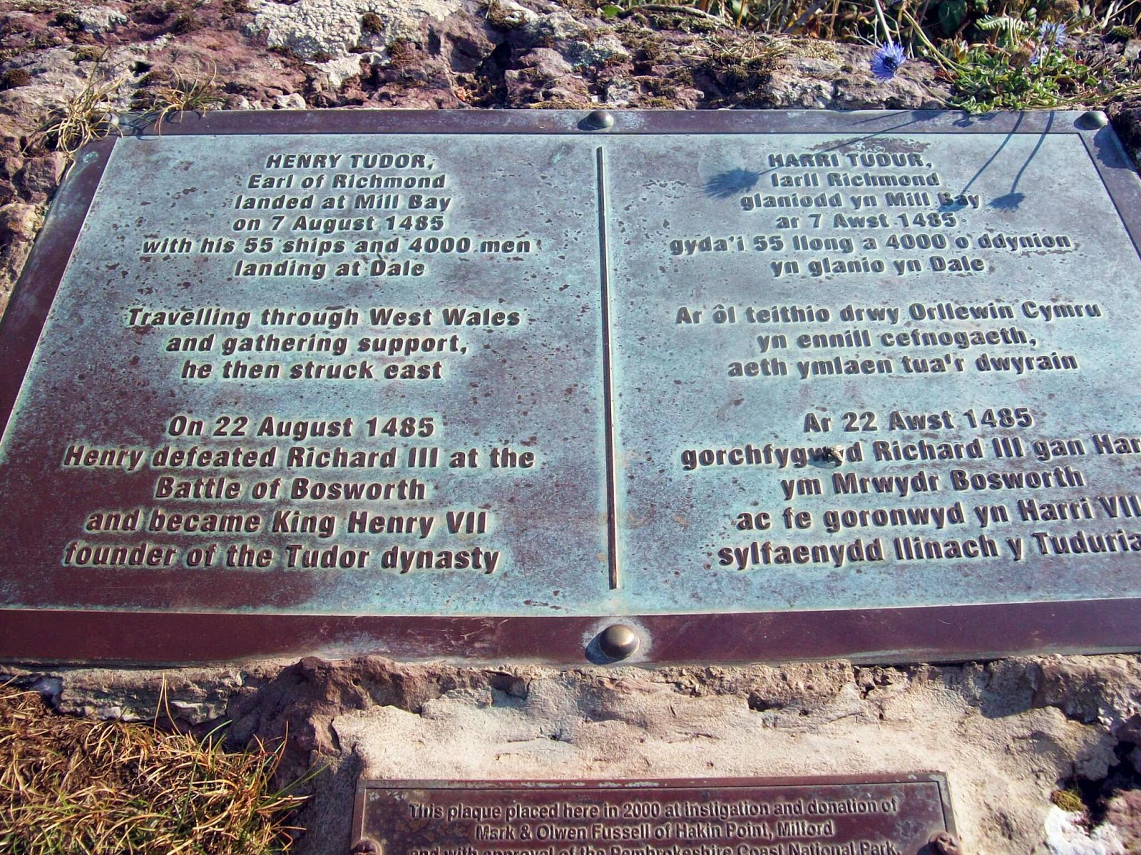
There was also some interesting history connected with Dale as it was here that Henry Tudor and his followers landed.


No wonder he picked this lovely part of Wales.


Why travel to the Med.?

Irish Ferry

On entering Dale village we came across the sculpting work of Sean Kehoe


Wednesday, 17 September 2014

Foel Fraith and Area

Just to cause confusion the "navigator" who is just back from the Alps thought a Wednesday walk would be a good idea and his suggestion was a walk in the Foel Fraith area.

Route

We parked at the lower car park on the road which leads from Llangadog to Brynamman. This road recently appeared on the ITV4 Bike Show as one of the best hills for cycling. Presumably for those with lungs and legs of steel.

We walked up into the quarry which is now part of an interpretative trail which explains the limestone industry. There is a link here, although the web site needs updating as the trail is now marked and in being.

Route of new limestone trail

Trail marker

We left the trail and headed for the waterfalls of the Afon Clydach which with the recent lack of rainfall was lacking in splendour.  We did however see a leylandi tree which appeared out of kilter with the landscape.

How did that tree get there?

The route continued to overlook the Tyle Garw and turned south to wander over the wilderness to disused quarry buildings where we had lunch.

A deep shake hole

pond

The return journey headed over Cefn Carn Fadog, Foel Fraith and the unnamed top at the trig point at 616m before heading back down to the car.

Trig at unnamed summit

No idea

Carn on unnamed summit


Monday, 18 August 2014

Sinc y Giedd

Monday's trip was to head east and visit Sinc y Giedd. This is where the Afon Giedd disappears underground.

Route

We parked in a lay by a church not far from the DanYr Ogof cave complex and then headed up Cwm Haffes.

Cwm Haffes


The rain which was supposed to have stopped by 1100 failed to agree with the Met Office and it was on with kit and off again.

We had lunch at Sinc Yr Giedd, with no sign of any water and I assume it had sunk somewhere else.

Sinc Y Giedd

No sign of river
Following lunch we continued in a south easterly direction passing numerous shake holes and the like.

Wilderness

sink hole

Fan Gyhirych


An afternoon break was taken by a large pond before our final descent back to the car the sun now shining.

This is not Peru

Thursday, 7 August 2014

Brecon

7/8/14

This walk decision was taken by Mrs Navigator as this was the annual camping trip to the Brecon Jazz Festival.

The "Navigator" and I are engaged to help erect the tent (marquee) where the cool lady will be staying.

Obviously we also incorporate a walk and here's the

Route


Our first objective after parking the car was "Y Gyrn". a steady climb through bracken and stone.


As gained the top Pen-y-Fan and Corn Ddu came into view.


We then headed down towards Storey Arms where a small army of holiday walkers were heading up to Pen-yFan.


 Our route was across the main road following the Beacons Way towards Craig Cerrig Gleisiad and then down to the car.


I can report that the tent was successfully erected near Brecon. I have no idea what happened later as what goes on on tour stays on tour!